The paper that can't be bought!
I had heard of Middle Percy way before our first trip up the coast but knew little in depth. Our old friend Tyrone of SV "Sahara" had told us of his visits when he was a skipper of a prawn trawler back in the 70's. Until I started investigating the whole story there was really very little published of this drama. So, here it begins as printed in issue # 2 of TCP as a destination piece.
Favourite Hangouts; Middle Percy Island By Bob Norson
IN calm weather, we motored mostly east from Curlew Island, where we had spent the previous night at anchor in a small bay on the west side of the Island. Doing a casual 5 knots we were overtaken by a powerboat as we brought the Percy's in sight. We exchanged smiles and waves as they planed by on a similar bearing.
For years I had heard the Percy's mentioned by yachties, trawler skippers, and fishermen. A favourite place to all. Besides being in a convenient spot on the North-South boatie migration route, there is good fishing, reasonable anchorages, and charm. Mountains of charm.
Our first stop when we arrived that day was West Bay. Though the anchorage has a generally vile reputation, we caught it in perfect conditions. With our 6.5 ft. draft, we anchored well off the white sand beach and rowed ashore for a look. In its natural state the bay would have been attractive, but much work planting coconut palms and building shelters rendered a special... well… charm.
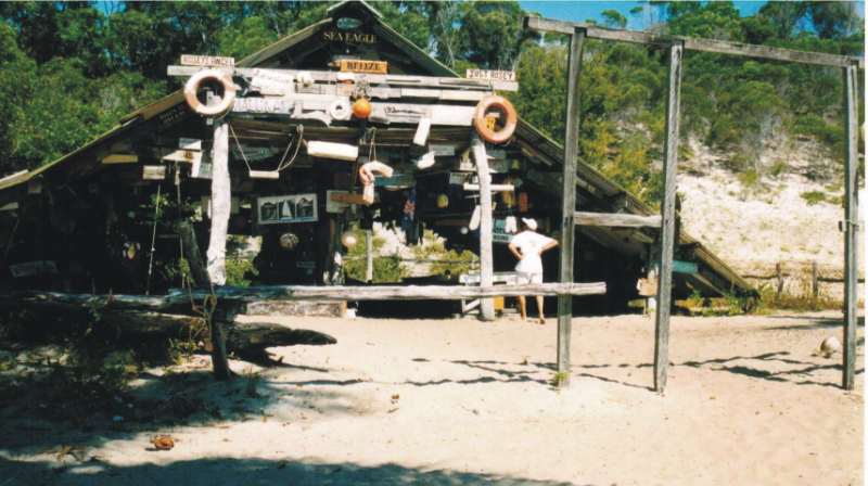
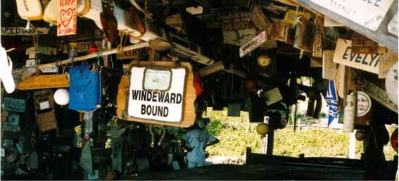
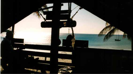
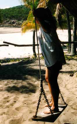
Besides the coconut palms, the first thing to greet the eyes is the A frame. Not far away to the left is the "phone" hut. As I understand, the original structure. Both places are covered in signs and souvenirs from passing boats. A rich history of boating is revealed. Given time to sort through the lot, I found signs from boats I had read about years ago. No boat can pass into legend without staking out a niche at "Andy's" West Bay.The A frame has the feel of a funky children's clubhouse. Swings, hammocks and other devices of entertainment, along with benches, tables and huge pit BBQ, suitable for roasting whole beasts. And everywhere…the signs. Some painted and decorated with great care, others very casual, but everywhere the names of passing boats and crews.
A short distance away is the tree house, which takes the children's clubhouse theme a step further.Arranged on a hillside, the view from the "upstairs" bedroom is a beaut.
The effort that was put into the place to provide some comfort and fun for passing boaties is unique, I think. Which brings me to the point. Failing health and personal causes induced Andrew Martin to leave his Island several years ago. I understand relatives have assumed the lease, and though apparently tolerant and friendly to passing boaties, the "clubhouse" was Andy's project and is quickly falling into disrepair.A boating icon is being consumed by time. The time to go to the Percy's is now, while it still stands. You don't want to compromise your future legend status, do you?
Have I been back since the first time?
Oh yeah, and will again the first chance. There is a lot more to appreciate there, and I would like to meet the new lease holders.
Have I left a sign? Dumb question! Look for "White Bird"...THE FACTS:
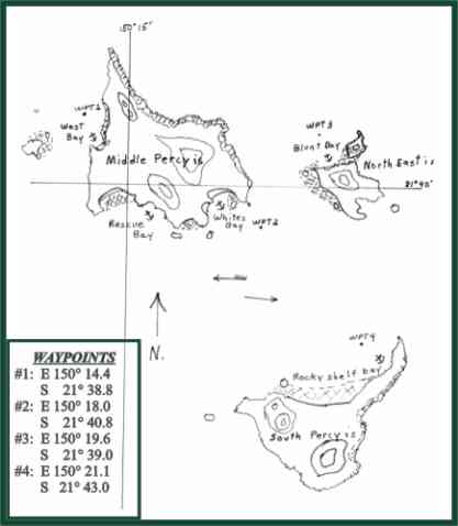
At about 21°40' S and 150°15' E, Middle Percy may be the most visited of the group. As mentioned, West Bay can be a rollie anchorage. There is an inlet on the north side of West Bay, with a tidal entrance that gives access to a hole probably suitable even for a cyclone.
For northerlies, I prefer Whites Bay. The shelter is good and few hazards. Rescue Bay has northerly cover, but I wouldn't without good light for spotting coral and rocks.
South Percy has a variety of anchorages when the southerlies are in, but most consider North East Island the better shelter.
Tides in the area are strong, especially the channels between the Islands. To plot direction of the current I refer to the Broad Sound as the destination for the flowing water on the flood, and as the source of the current on the run out. As you would expect, a wind against tide can create wicked seas. Boaties using only a compass bearing for navigation around here can find themselves well off course quick smart.Small motor boats leaving Sarina or St. Lawrence should make their approximately 55 NM trip in 2 or 3 hours. Normally you wouldn't advise a small boat to take this trip, but with settled weather and the fact that there are strategically placed Islands for shelter along the way, it's tempting. Bring plenty of water and fuel.
Though care has been taken to be accurate in this information, "Bob's Mud Map" is no substitute for a proper chart.